Take off at the right moment.
Forecast turns weather models into a flight decision: a score for each slot, the wind layer by layer and a simulated trajectory before you hitch the trailer.
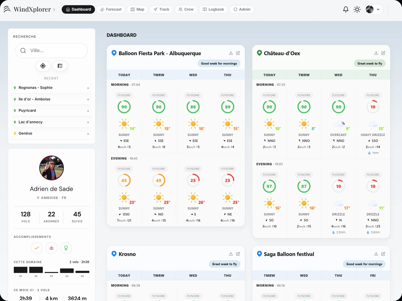
Flyable or not? See it at a glance.
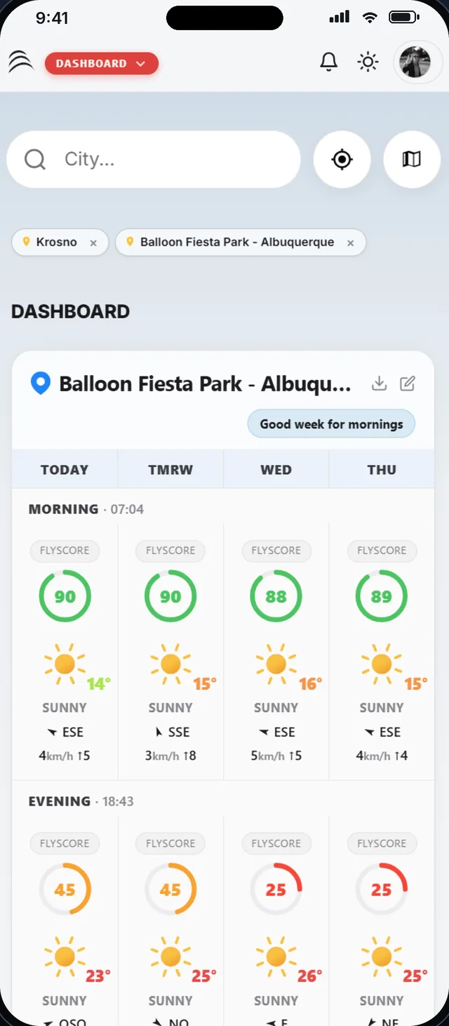
The dashboard shows the morning and evening FlyScore for each of your places, over four days. Slots are aligned with sunrise and sunset.
- Your favourite places, by city, GPS or map
- Temperature, wind direction and speed, gusts, rain
- The week's trend in one line
- A score computed with your own wind limits
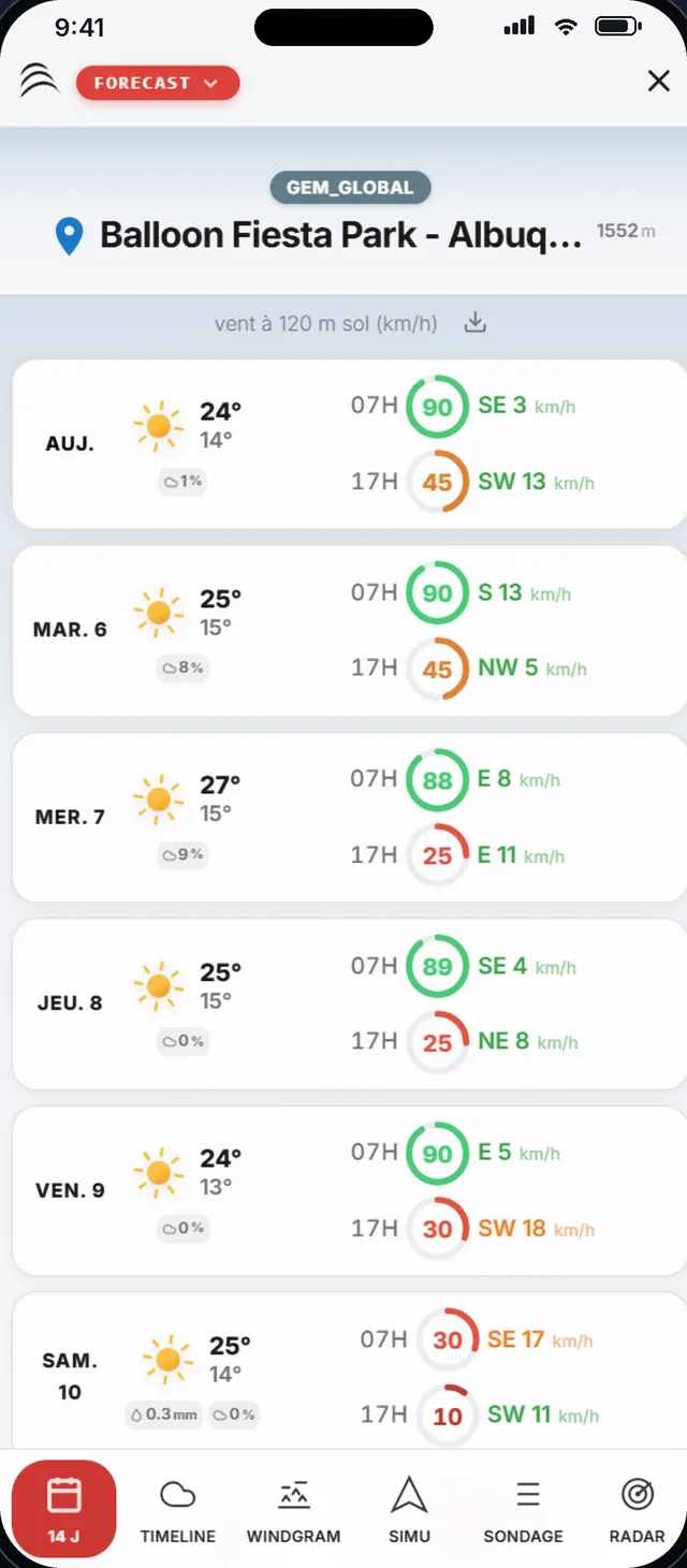
14 days of FlyScore to spot your window.
One line per day: main weather, temperatures, rain, then the morning and evening FlyScore and wind at 120 m. Beyond seven days, the trend is indicative only.
- Green, orange or red according to your wind limit
- Wind at 120 m above ground to anticipate drift
- Image export for your crew
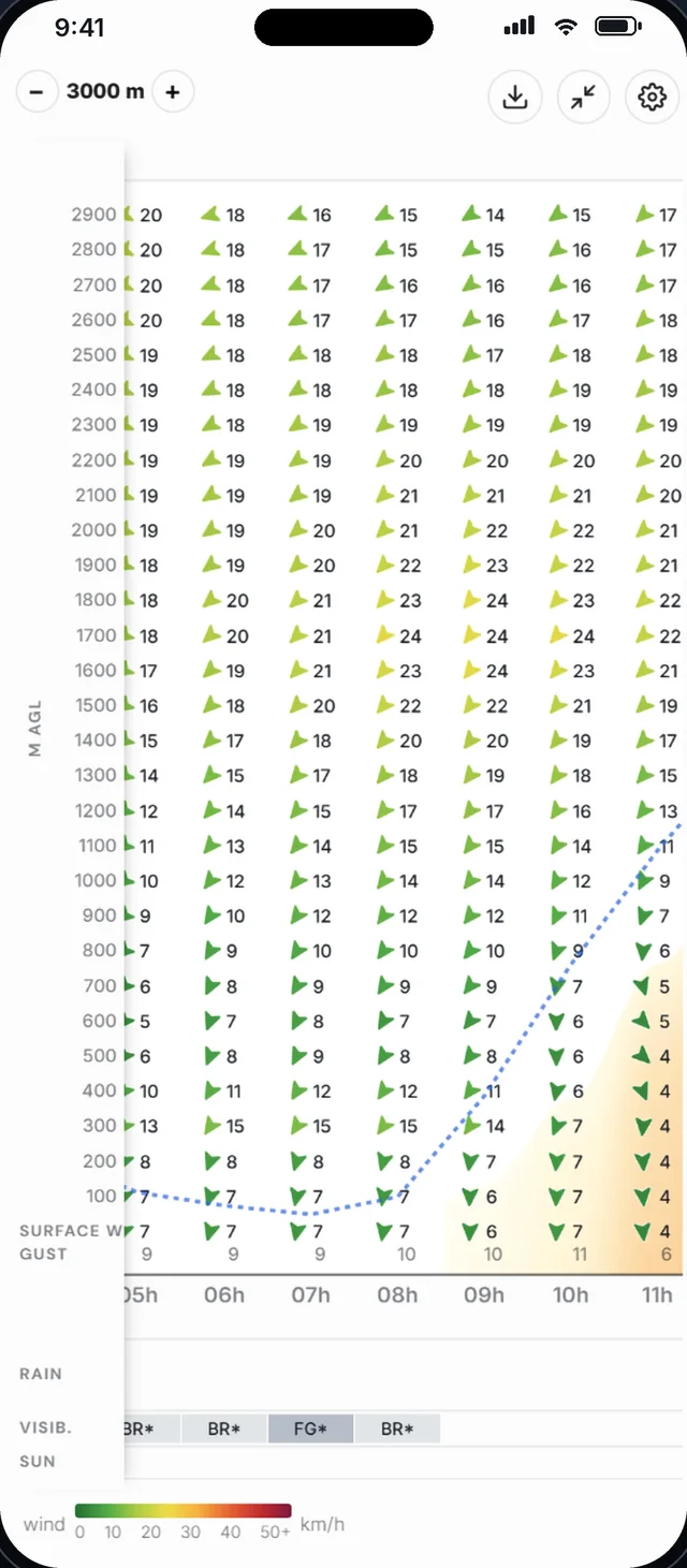
The wind, layer by layer, hour by hour.
The windgram crosses time and altitude: balloon heading and wind speed for each level up to 3,000 m, from sunrise to sunset.
- Surface wind and gusts
- Thermals, cloud base and 0 °C level
- Rain, visibility, sunshine
- Metres or feet, km/h, knots or m/s
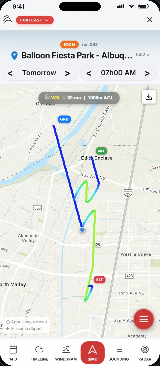
Simulate your trajectory before you take off.
Choose the place, the time and the flight duration. WindXplorer draws three trajectories: near the ground, at cruise altitude and a mixed profile.
- Trajectories coloured by altitude
- Topo, satellite or aeronautical chart with airspace
- Drag the launch point to move it
- Adjustable climb rate and cruise altitude
FlyScore, a number a pilot can discuss.
Each parameter gets a mark from a grid of thresholds, then the marks are weighted. Some parameters cap the score whatever the rest: seven good parameters do not make up for a CAPE of 1,200 J/kg.
- Not flyable0 – 29
- Unfavourable30 – 49
- Marginal50 – 69
- Favourable70 – 84
- Excellent85 – 100
From 70 up, the slot holds. Between 50 and 69, a point of caution is identified. Below 50, the trailer stays home.
What weighs in the score
Surface wind and gusts account for 45% between them: most cancellations are decided at inflation and landing, not at altitude. Thermal activity acts as a graded veto and caps the score at 60, 45 or 25 depending on its level.

All of Forecast, in detail
- TimelineThe day hour by hour: surface wind, gusts, weather, thermals, thunderstorm risk, QNH, CAPE, Lifted Index and clouds by level.
- SoundingThe full vertical profile at flight time: wind and humidity at each level.
- RadarOne last look at precipitation before you leave.
- Multi-modelAROME, ICON-D2, ICON-EU, ECMWF, GFS, UKMO, GEM and more: pick the finest model for your area.
- Airspace and NOTAMsAeronautical zones on the map and NOTAMs for the area to plan your route.
- AI-assisted decisionA reasoned go / no-go summary built from the slot's data.
- Places, waypoints and POIsYour launch fields, targets and points of interest, synced on all your devices.
- ExportsWindgram, timeline and forecasts as images, ready to share with your crew.
Ready for take-off?
Join the pilots who made WindXplorer their copilot.